


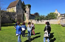


This tour allows you to discover 6 armoured bollardswith 6 different coats of arms, set up in 1540 around the woods of the connétable Anne de Montmorency and the chapter of Saint-Rieul de Senlisand 1 engraved terminal. You can also see the entrance to an old sand quarry and one of the Halatte forest posts, which have been in place since the 18th century.
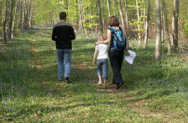
- Departure : car park in the forest, on the left just as you enter Aumont-en-Halatte from the D330 (car park indicated on the IGN map or use the GPS coordinates)
- Duration : 1h30 to 2h
- Distance : 4.3 km
- Difference in altitude : 40m
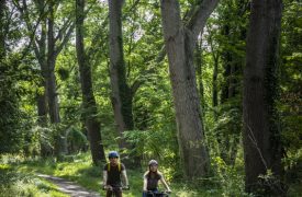
- Nature of the roads : 30% passable road - 70% dirt road - of which 300m potentially muddy before the Mont Alta post
- Difficulty : No walking difficulties, except perhaps in muddy areas. You will need to pay close attention to the map. The base of the milestone (2) can be difficult to find. Don't waste time there, it's not the most interesting point.
- Points of interest : 7 armorial bearings or engraved, 1 post and the entrance to a sand quarry
Route details
At the entrance to the car park, to the right of the large wooden sign for the Halatte national forest, take the Arbre à Fougères road, which climbs to the north-east. The road runs alongside an old sand quarry, the entrance to which is 140m on the right.
1-Ancient sand quarry
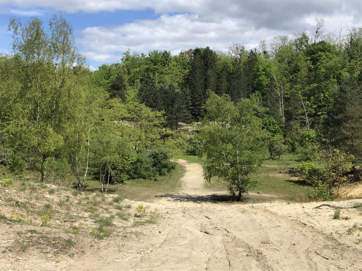
The sandy areas are numerous throughout the three forests of Chantilly, Halatte and Ermenonville, the most famous being the site of the la Mer de Sable theme park in Ermenonville.
Sand mining, in particular for the glass industryQuarrying, historically by Saint-Gobain, was important in Aumont-en-Halatte, but has been completely stopped since the Second World War. A few quarries are still active in the north-east of the forest.
Continue straight ahead on the road, which climbs for another 760m to the Aumont crossroads, where it intersects with the route de Condé and the Mont Alta forest road. Take the continuation of the Arbre à Fougères road exactly opposite, at the same level (the two roads on the left go down and the one on the right goes up). 250m further on, at the fork in front of you, leave the forestry machinery track on the left and continue straight on, slightly to the right). Continue for 300m until you come to a junction with a track coming from the left and a sharp bend to the right. 20m after this intersection, on the left-hand side of the track, halfway round the bend and 3-4m from the fence, is a bollard base.
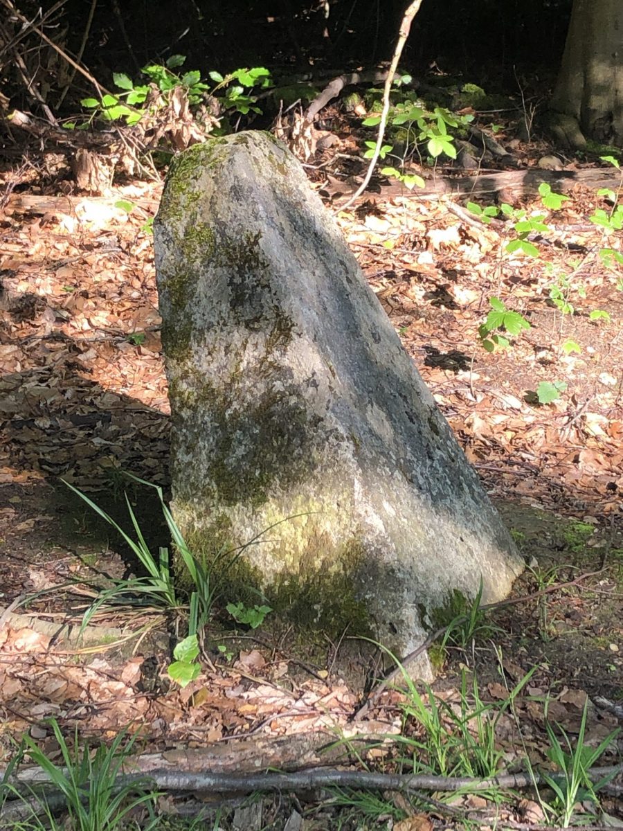
2 Bollard base
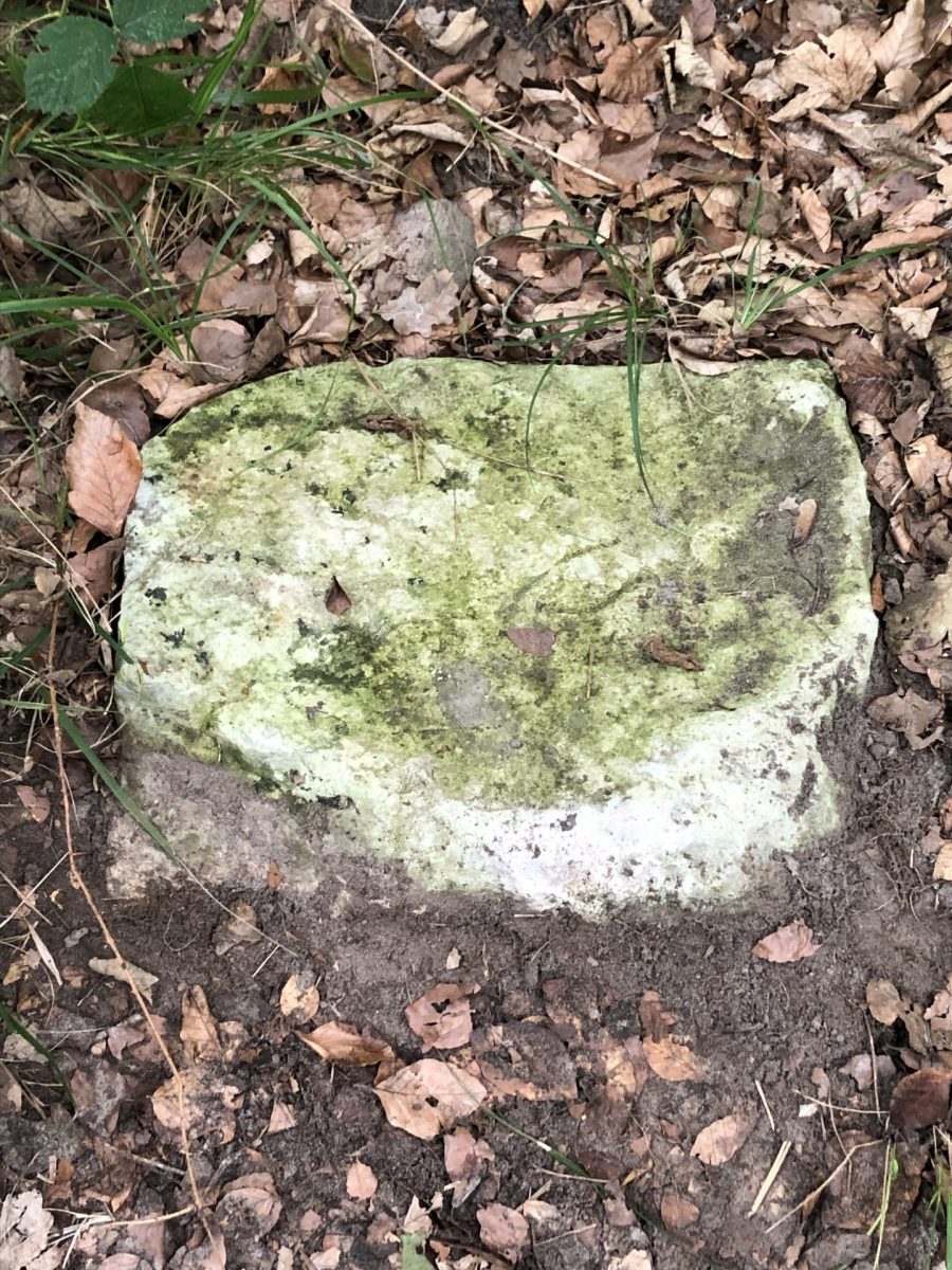
This is the base, the buried part, of a milestone at the junction of three plots, of Constable Anne de Montmorency, the King and the Bishop of Senlis.
The cross-section, which is only a few centimetres above the ground, shows the start of the faces that were to bear the coats of arms of the owners of the plots.
The causes and date of the destruction of this bollard are not known. However, as the base is well anchored in the ground, it was deliberately destroyed, without any connection with forestry operations. What was the aim: to remove markers from the Ancien Régime, or to cut out an example of an emblazoned boundary stone to keep it in another place?
Follow the route de l'Arbre à Fougères for 100m. The milestone is along the path on the left.
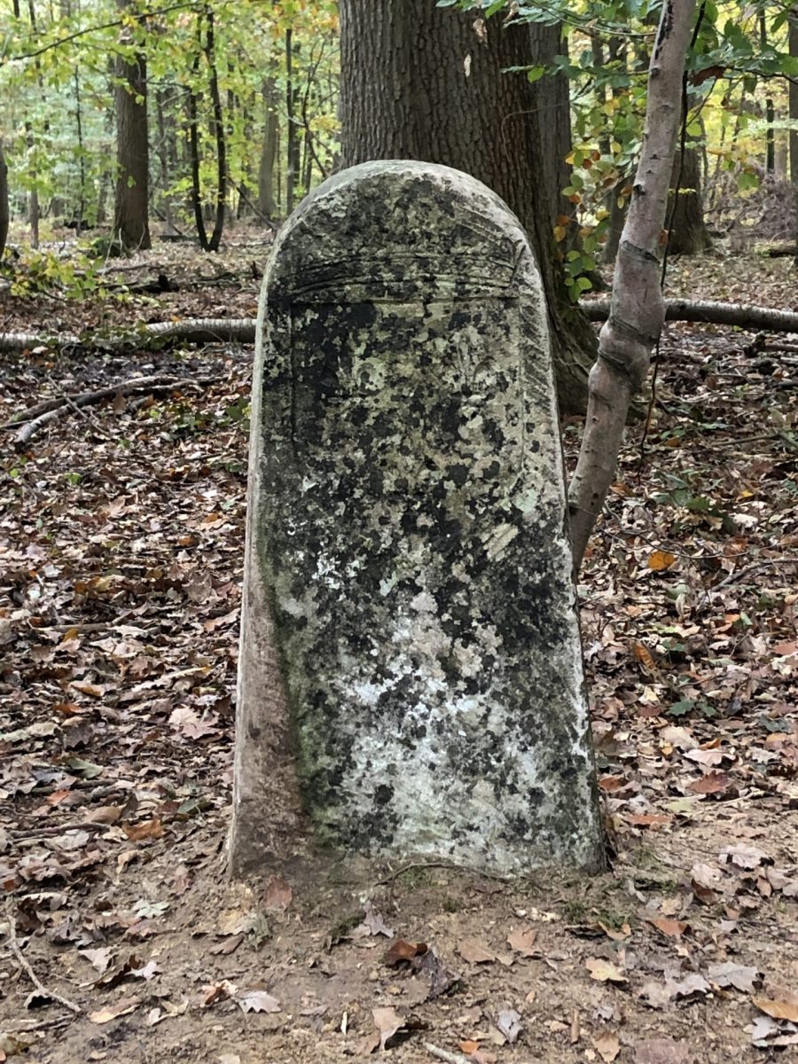
3-2-sided escutcheon, 2 coats of arms
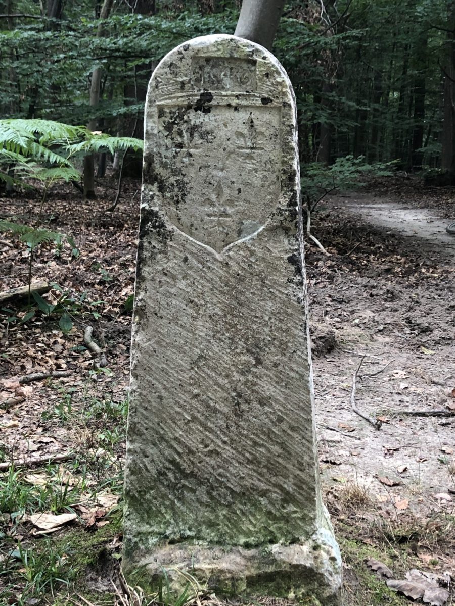
This marker is the most remarkable and easiest to find in the forest.
Like the next two terminals, it has on one side the coat of arms of the King of France on the one hand, and the Constable Anne de MontmorencyHere the date is 1540 on the side of the King of France.
This boundary marker is not well positioned. Normally, an owner's coat of arms faces his land and the top of the bollard indicates the parcel boundary.
Roughly speaking, the right side of the road belongs to the Constable and the left to the King. The milestone is perpendicular to the road. It is likely that this milestone served as a road marking for hunting purposes in the 17th and 18th centuries. Then dug up so as not to get in the way, it would have been reinstatement along the way, but without respecting its orientation. A 1905 photo shows the milestone in its entirety, out of the ground.
Follow the route de l'Arbre à Fougères for 90m. The milestone is on the left, 3m down the road.
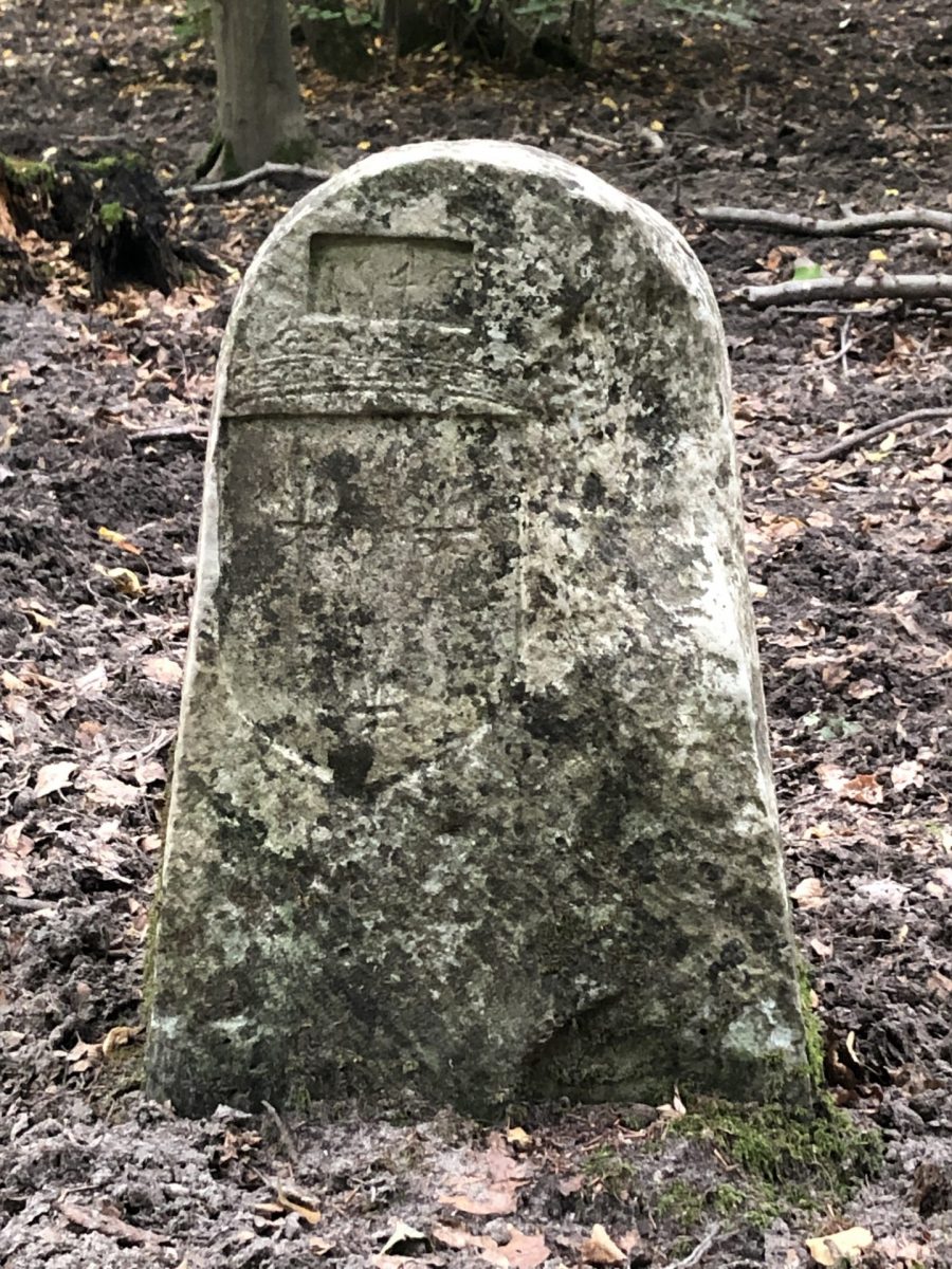
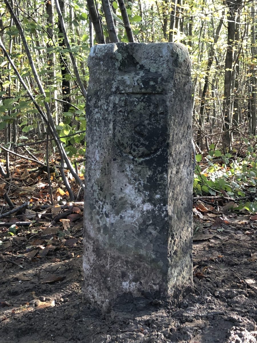
4-2-sided escutcheon, 2 coats of arms
This bollard had been dug up and laid on the ground. It was the subject of a reinstalled during the bollard rectification campaign in November 2023. Its position was previously defined by a surveyor, taking into account the other milestones. Today we can clearly see the alignment of the four terminals one after the other.
On the south side, facing the wood he had surrounded in 1540, is the Livrée Wood, the arms of Constable Anne de Montmorency and the date. To the north, facing Bois du Roiare thehe coat of arms of the Kings of France The three fleurs-de-lys crest surmounted by the royal crown. This coat of arms with three fleurs-de-lys is often reused by royal cities or religious establishments founded by a king.
Follow the route de l'Arbre à Fougères for 110m. The milestone is on the left, 20m from the road.
5-2-sided escutcheon, 2 coats of arms
This terminal, in its original positionpresents the coat of arms of the King of France and date on the north side and those of Constable Anne de Montmorency on the south side.
The north-west corner of the milestone has been broken before engraving, as the royal coat of arms is off-centre and reduced to fit on the flat part.
The arms of Constable Anne de Montmorency consist of a quarterly of 4 times 4 alerions (small eagles used in heraldry) commemorating of the Montmorency victories Above the shield, a tortil, the baron's crown, Anne de Montmorency's title in 1540; around the shield, the collar of the Order of Saint Michael, interlaced shells and a medallion of the Archangel Saint Michael slaying the dragon. Finally, on either side, the sword of the Constable of France, recognisable by the fleurs-de-lys on the pommel. Anne de Montmorency was appointed Constable of France by François I in 1538.
Follow the route de l'Arbre à Fougères for 120m. The milestone is on the left, 25m down the road.
6-3-sided escutcheon with 3 coats of arms
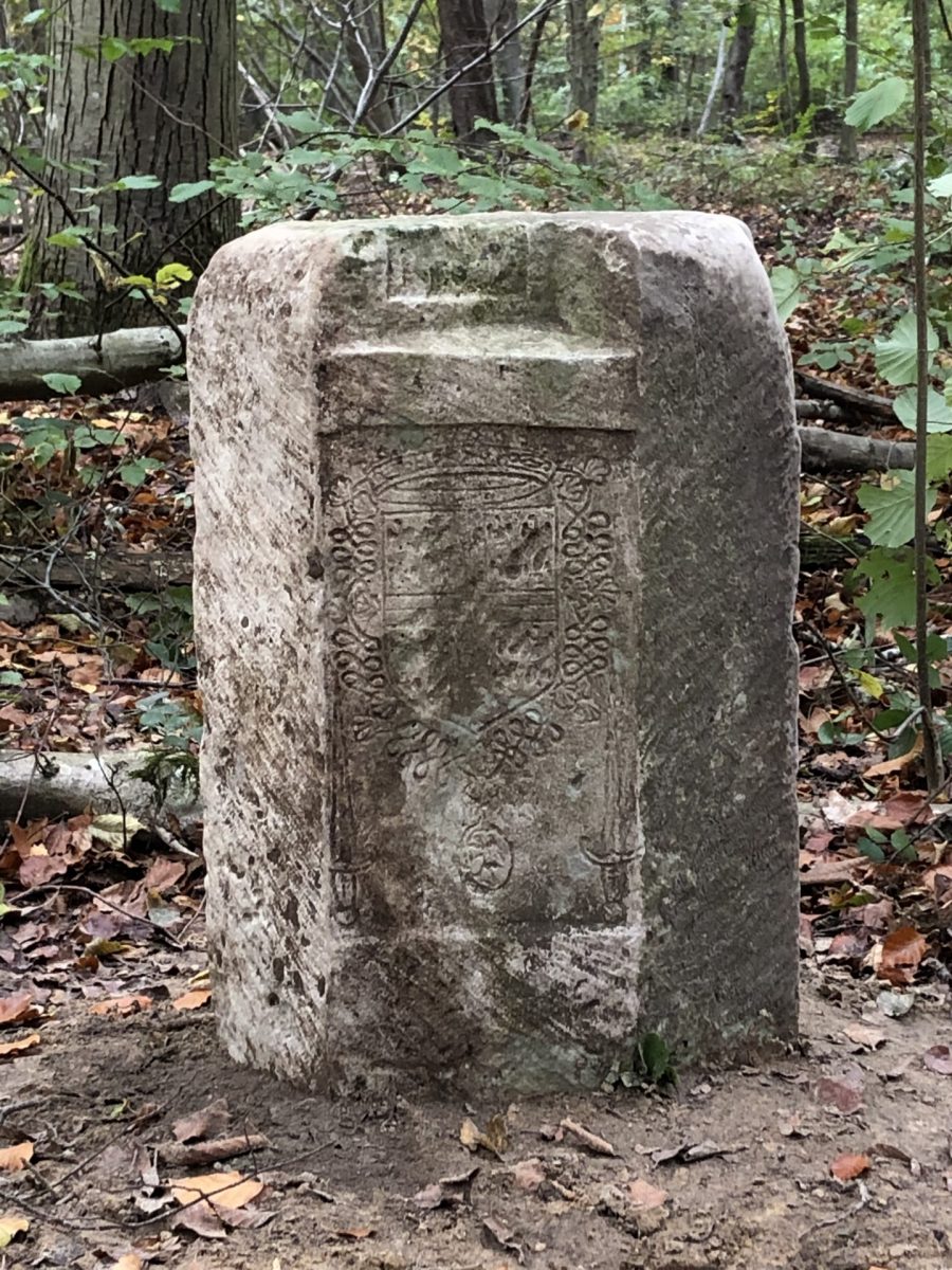
The milestone is at the junction of three plots. You can see the coats of arms of the Constable de Montmorency and the King of France. The third side features an escutcheon containing "Le Morel written in Gothic. This refers to Jean or Jehan Morel, lieutenant of the baillage of Senlis in 1540 ("The" for "I"). Le Bois Morel, whose other landmarks we will see later, is the city's bailiwick wood.
The top of the bollard shows, in relief, plot boundaries. This is clearly visible when several plots join, as is the case here, but it is also the case when there is an inflection in the plot boundary. This feature is exceptional in France.
This bollard had been dug up and laid on the ground. It was also put back in place during the terminal rectification campaign at the end of 2023.
Follow the route de l'Arbre à Fougères for 230m to the Mont Alta crossroads.
7-Poteau du Mont Alta
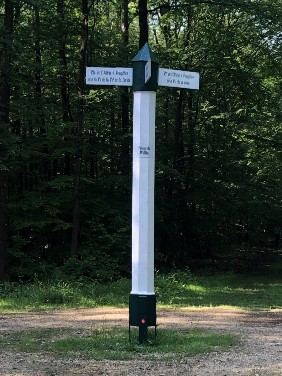
Mount Alta is the hill we're standing on, 142m above sea levelwhose name is associated with that of the Halatte forest.
The crossroads is at the intersection of Route de l'Arbre à Fougères and Route Sarrobert. It is not at the highest point, as we are only 139m above sea level.
The Mont Alta poleThis post, which appears in the 1733 State of the Forests, had disappeared. A new post, made identically to the old one, has recently been put in place by APTF, Association des Poteaux des Trois Forêtswhich is responsible for maintaining, renovating and safeguarding these buildings. historic posts on the three forests of Chantilly, Halatte and Ermenonville.
Take the Sarrobert road to the right, towards the Arthus crossroads to the south. The next milestone is along the path on the left, 60 m from the Mont Alta post.
8-Engraved horn
This boundary marker, and the next one, mark the eastern boundary of Morel Wood, the first boundary marker of the western boundary with Constable Wood. This is not the series of armorial markers from 1540, but markers identified by letters, i.e. simply engraved.
On its eastern edge, the Bois Morel borders ona wood at Saint-Vincent de Senlis Abbey. This milestone is engraved with the letters RSV which mean Religious of Saint-Vincent.
There is no engraved date, nor any preserved document relating to this boundary, which is very different from that of 1540, but it is probable, by analogy with other boundary stones, that it dates from the 17th century.
The operation to rectify the bollards in November 2023 only concerned the armorial bollards. Another campaign will have to be undertaken for these.
Follow Route Sarrobert for 140m until it intersects with Route des Fossés, which comes from the left and is a passable road. After this intersection, continue south for 340m to the Arthus crossroads, then turn right onto the Route du Mont Alta, heading west. Walk 130m along the Mont Alta road and take the path on the left at "10 heures". If you go 40m further along this path, the milestone is along the path on the left.
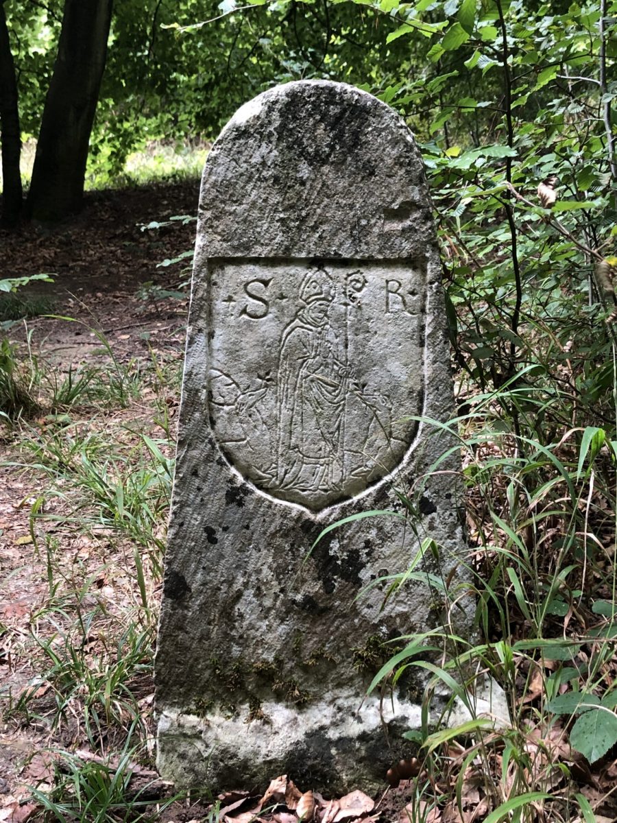
9-3-sided escutcheon with 3 coats of arms
The following two milestones do not mark the boundary of a Constable's wood, but a wood belonging to the chapter of the parish of Saint-Rieul in Senlis which benefited from this demarcation campaign. This boundary stone is at the junction of three parcels belonging to the Chapter of Saint-Rieul, the Bishopric of Senlis and the parish of Saint-Gervais d'Aumont-en-Halatte.
The north face bears the coat of arms of the chapter of Saint Rieul surmounted by the date 1540 and the south-west face the coat of arms of the bishopric of Senlis. On the south-east side, the parish of Aumont-en-Halatte is represented by a naive representation of Saint Gervaisrecognisable by the halo and the palm of martyrdom, framed by the letters S and G, with no escutcheon. Aumont-en-Halatte was a village of charcoal burnersThis is a very simplistic depiction of the poor.
Leave the layon and return to the Mont Alta road and go forward 80m. The milestone is on the right, 10m from the path.
10-2-sided escutcheon, 2 coats of arms
This milestone, which is in very good condition, bears the date 1540 on the south side and the coat of arms of the bishopric of Senlis In the middle is the S for Senlis, surmounted by two fleurs-de-lys (royal city) and crossed vertically by the bishop's crozier. The coat of arms of the chapter of Saint-Rieul represents the saint, first bishop of Senliswith mitre and crosier, framed by the letters S and R, and with a stag and a doe at his feet. Legend has it that his sermons were so enlightened that the frogs stopped croaking and the animals came to the church door to listen.
This milestone is aligned with the previous one, on the other side of the road, as the roads were laid out for hunting purposes in the 17th and 18th centuries, without taking into account the division of forest plots at the time.
Follow the Mont Alta road for 300m to the Aumont crossroads. Find the path you came on: turn left downhill towards the car park, which runs alongside the old sand quarry for 900m.
END OF ROUTE
Download the pdf file of the tour: